The curse of flexibility in transit
You hear it all the time. Buses are more flexible than rail. From point A, bus routes can take you to your favorite points X, Y, and Z, each in a single ride. They can detour around an accident. The routes can be altered to accord with population shifts.
But the curse of flexibility is that it gets used. It sounds like a truism, but bear with me. I believe the theme applies rather broadly, but I want to talk about the curse of transit flexibility.
The other day I was at the University of Waterloo after 7 pm and had to unexpectedly make it to downtown Kitchener. The 8 bus could get me there, but it was running at a 30 minute frequency. By that hour the 7 was running at a 30 minute frequency, on just one of its routings. The iXpress had the furthest stop and at that hour was also at a 30 minute frequency. I had the luxury of a choice between three different buses with separate schedules and bus stops — and infrequent service. Had the iXpress been running at a 10 minute frequency, I would’ve gone to that stop and not have wasted my time and energy trying to plan such a simple trip.
In contrast, transit infrastructure like light rail forces a choice of a corridor — and that’s where the service is concentrated, without being diffused among many routes.
Buses can detour. For some time this week road construction closed the north UW campus entrance, and separate construction closed the east side of Ring Road. That meant hell for transit users, who first had the realization that their bus wasn’t where they expect it, then had to figure out where it actually was, and of course the schedules were screwed up anyway. The iXpress did a detour of over 3 km between the UW stop and the R&T Park stop, taking a long time and getting stuck in the construction-related traffic along the way. Getting out and walking that same distance would have been faster.
Light rail can’t detour, so it forces construction to be done quickly, with minimal impact — and at night whenever possible.
Buses can have their routes moved in accordance with change in transportation demand, and the flip side is the absence of commitment that transit along a corridor will be provided in the years to come. So the location of transit routes cannot be used to directly inform decisions about where to live, or where to build. If you build fixed transit infrastructure (e.g. light rail), however, it’s a self-fulfilling prophecy. There is a tangible commitment to providing transit along that corridor, which is used to determine where to live and where to build, thereby itself shaping the transportation demand.
Precisely due to their flexibility, buses can do little to shape or direct urban form and land use. So they have no choice but to react. They can demand little of any forces that hinder their operations. And a bus system’s flexibility in providing service from any point to any other point makes it difficult to consolidate service into select, high quality routes that are easy to understand and use.
Missing sidewalks in Kitchener-Waterloo

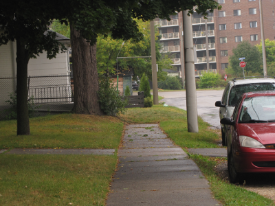
For a city to be open to pedestrians, there need to be paths between useful destinations, the paths need to be maintained, and pedestrians need to feel safe. Before you can run, you have to walk, and before you can walk, you need a place to do it. In Kitchener-Waterloo there are numerous roads that are missing sidewalks, often on both sides of the street. Sometimes the sidewalks are sporadic: they appear and disappear on a stretch of road. Occasionally one-sided sidewalks even switch sides at intersections. Suburban subdivisions are haphazard, sometimes having full sidewalk coverage, but just as often leaving them out. And sidewalks in industrial areas are simple: there just aren’t any.
I set out to document the state of missing sidewalks in Kitchener and Waterloo. Using Google Maps, I drew red lines for roads missing sidewalks on both sides and blue lines for those missing a sidewalk on just one. I tried to cover everything that is not a suburban subdivision, and I did Eastbridge as an example of a suburban area. There are undoubtedly missing sidewalks that I did not document, and probably some tiny sidewalks that I mistook for curbs. Click on the below map image to see it on Google Maps in more detail. [Update: This is based on 2006 satellite imagery, and a few sidewalks have been put in since then.] Read More…
Reality-based transit planning
Discussion, planning, and design of transit systems that aims to get people to use them must be based on what people actually do rather than on what they should do. The more in line with people’s actual use a transit system is, the more useful and economically efficient it is.
It is irrelevant how far people should want to walk to get to transit. The reality is that they are not willing to walk far, though the more complete reality is that they are willing to walk further to get to a train than to a bus.
It is irrelevant that people could plan around infrequent service. Very few are willing to do so.
It is irrelevant that people should take the bus to get to where they need to go. Either they will or they won’t, and empirical evidence all over the world says that they will do everything in their power to avoid buses.
This is why I have been talking about perception and simplicity. Because at the core of a transit system are people who have to navigate it using their faculties of perception and memory (and more), and who also do not derive equal pain or pleasure from the various modes of transportation. Paternalistic transit planning based on what people should do is self-defeating.
